
A few minutes ago Google has announced from its blog that Maps will receive a major update that will offer more details and colors in the landscapes and streets of the maps.
That is, we will have a map that is richer in colors and details so that we can better understand the geography and extent of any region. In fact Google has shown the differences between the current details and those that we will soon have in one of the best applications we have on our mobile.
The goal of this update is to provide the user with the most enriching view map ever seen in a mapping application. If we count on that Maps has the mapping of 220 countries and territories, reaches an area of 100 million square kilometers of land.
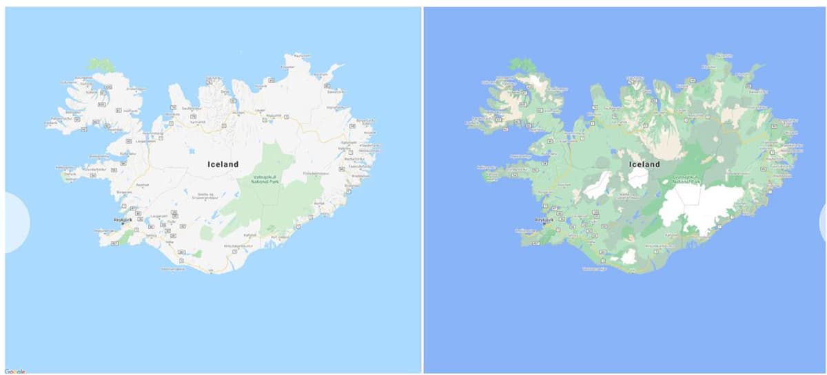
For this he has used a new color mapping technique capable of identifying the varied topography of the planet, which includes mountainous, forested, frozen and arid regions. That type of geography has colors assigned in the HSV color model, making it easier for the end user to distinguish between forests, shrubs, and more.

As we have said, Google has published a series of maps in which you can see the differences between one and the other region with the current map and what will be next. Areas such as Iceland, Morocco, Croatia or Arizona are some of the examples and that we share so that you can take a look at the more than visible differences.
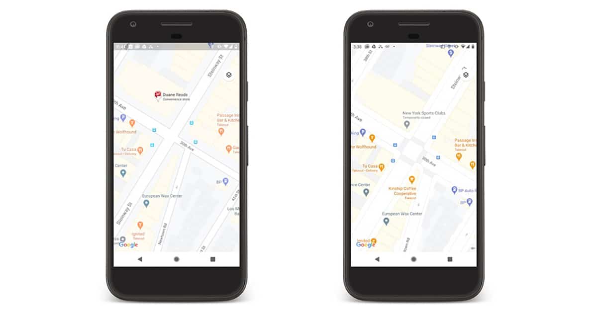
And not only has this update "touched" natural landscapes on maps, but metropolitan areas are also improved as with smaller towns and cities. We need to have better details in road information by accurately showing the shape and width of roads to scale.
And importantly, crossings, sidewalks and zebra crossings become more visible, so generally speaking one of the basic elements of Google Maps is going to get a big update; don't forget how properly calibrate the Maps compass with its new feature.